• FluTrackers.com Inc. does not provide medical advice. Information on this web site is collected from various internet resources, and the FluTrackers board of directors makes no warranty to the safety, efficacy, correctness or completeness of the information posted on this site by any author or poster. The information collated here is for instructional and/or discussion purposes only and is NOT intended to diagnose or treat any disease, illness, or other medical condition. Every individual reader or poster should seek advice from their personal physician/healthcare practitioner before considering or using any interventions that are discussed on this website. By continuing to access this website you agree to consult your personal physican before using any interventions posted on this website, and you agree to hold harmless FluTrackers.com Inc., the board of directors, the members, and all authors and posters for any effects from use of any medication, supplement, vitamin or other substance, device, intervention, etc. mentioned in posts on this website, or other internet venues referenced in posts on this website.
  • We are not asking for any donations. Do not donate to any entity who says they are raising funds for us.

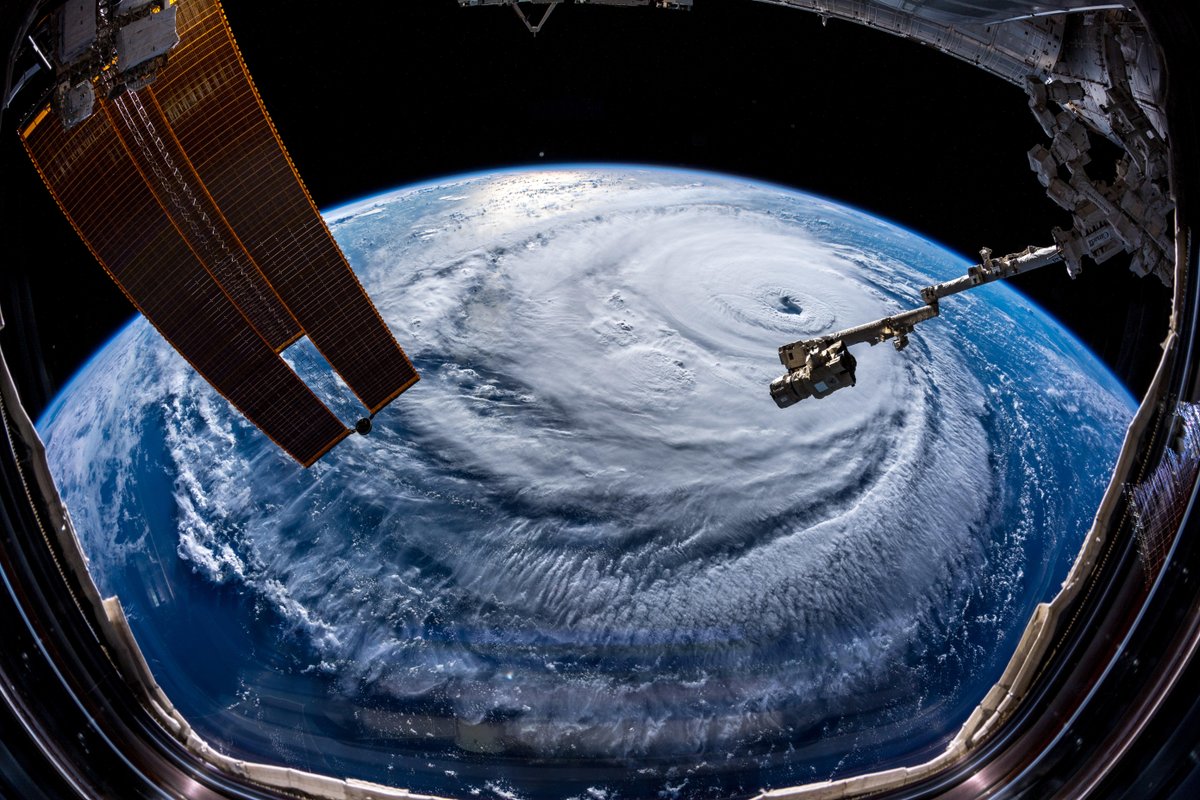
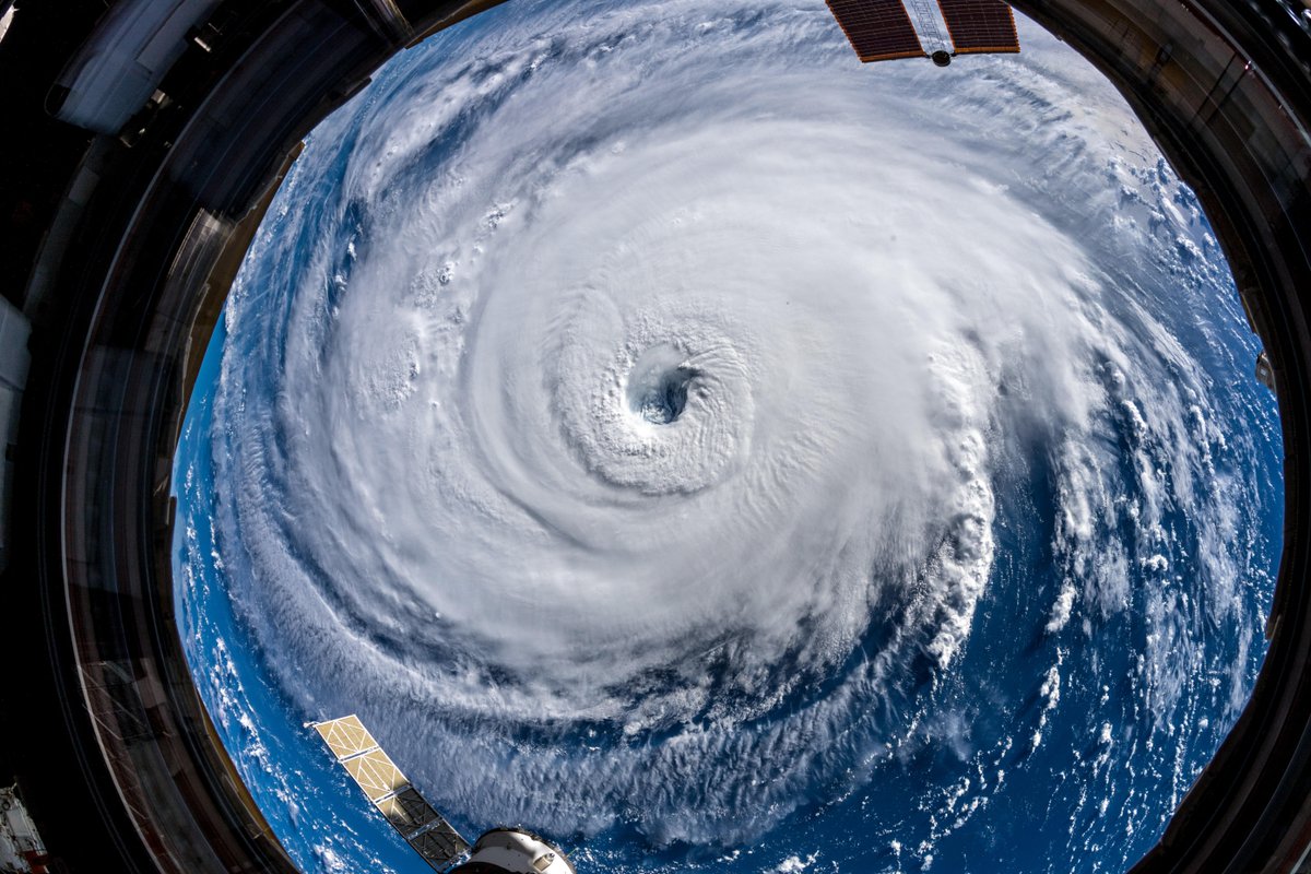
US - Hurricane Florence reduced to a category 2 status - 11 pm ET, September 12, 2018

sharon sanders

Editor-in-Chief & President
BULLETIN

Hurricane Florence Advisory Number 46 NWS National Hurricane Center Miami FL

AL062018 500 PM AST Mon Sep 10 2018 ...

FLORENCE GROWING IN SIZE AND STRENGTH... ...
HURRICANE AND STORM SURGE WATCHES COULD BE ISSUED TUESDAY MORNING...

SUMMARY OF 500 PM AST...2100 UTC...

INFORMATION ----------------------------------------------

LOCATION...25.4N 61.1W ABOUT 525 MI...845 KM SSE OF BERMUDA ABOUT 1170 MI...1880 KM ESE OF CAPE FEAR NORTH CAROLINA MAXIMUM SUSTAINED WINDS...140 MPH...220 KM/H PRESENT MOVEMENT...WNW OR 285 DEGREES AT 13 MPH...20 KM/H MINIMUM CENTRAL PRESSURE...939 MB...27.73 INCHES WATCHES AND WARNINGS --------------------

There are no coastal watches or warnings in effect. Interests in the southeastern and mid-Atlantic states should monitor the progress of Florence. Storm Surge and Hurricane watches could be issued for portions of these areas by Tuesday morning. DISCUSSION AND OUTLOOK ----------------------

At 500 PM AST (2100 UTC), the eye of Hurricane Florence was located near latitude 25.4 North, longitude 61.1 West. Florence is moving toward the west-northwest near 13 mph (20 km/h). This general motion with an increase in forward speed is expected during the next couple of days. A turn toward the northwest is forecast to occur late Wednesday night.

On the forecast track, the center of Florence will move over the southwestern Atlantic Ocean between Bermuda and the Bahamas Tuesday and Wednesday, and approach the coast of South Carolina or North Carolina on Thursday. Data from a NOAA Hurricane Hunter aircraft indicate that maximum sustained winds have increased near 140 mph (220 km/h) with higher gusts.

Florence is a category 4 hurricane on the Saffir- Simpson Hurricane Wind Scale. Further strengthening is anticipated, and Florence is expected to be an extremely dangerous major hurricane through Thursday. Hurricane-force winds extend outward up to 40 miles (65 km) from the center and tropical-storm-force winds extend outward up to 150 miles (240 km). The estimated minimum central pressure from NOAA Hurricane Hunter aircraft data is 939 mb (27.73 inches).

HAZARDS AFFECTING LAND ----------------------

SURF: Swells generated by Florence are affecting Bermuda and portions of the U.S. East Coast. These swells are likely to cause life-threatening surf and rip current conditions. Please consult products from your local weather office.

NEXT ADVISORY ------------- Next complete advisory at 1100 PM AST. $$ Forecaster Blake


https://www.nhc.noaa.gov/text/refres...l/102053.shtml
 
[h=1]Preparing for a Hurricane or Tropical Storm[/h]

You can?t stop a tropical storm or hurricane, but you can take steps now to protect you and your family.
If you live in areas at risk, the Centers for Disease Control and Prevention (CDC) encourages you to begin preparing for hurricane season. The Atlantic hurricane season is June 1 through November 30 each year.
Please follow these important hurricane preparedness tips from CDC:
After you have read these tips, please review the other resources available on the CDC Hurricanes website. You can also check out CDC?s new reference document that contains key messages on hurricane and flood related health threats. The Preparedness and Safety Messaging for Hurricanes, Flooding, and Similar Disasters can help local responders quickly create and adapt health communication products for affected communities. The document contains messages on various topics including food safety, carbon monoxide poisoning, waterborne diseases, and mold.
CDC strongly recommends that you print all important resources before a hurricane strikes. Power outages during and after a hurricane can prevent you from accessing information online when you most need it. Preparing now can help keep you and your family safe.
  • Page last reviewed: August 22, 2018
  • Page last updated: August 22, 2018
 
006 WTNT31 KNHC 111734 TCPAT1 BULLETIN Hurricane Florence Intermediate Advisory Number 49A NWS National Hurricane Center Miami FL AL062018 200 PM AST Tue Sep 11 2018 ...FLORENCE GETTING BETTER ORGANIZED AND INCREASING IN SIZE... ...LIFE-THREATENING STORM SURGE POSSIBLE ALONG THE COASTS OF NORTH AND SOUTH CAROLINA...INLAND FLOODING TO FOLLOW... SUMMARY OF 200 PM AST...1800 UTC...INFORMATION ---------------------------------------------- LOCATION...27.1N 66.2W ABOUT 370 MI...595 KM SSW OF BERMUDA ABOUT 845 MI...1360 KM ESE OF CAPE FEAR NORTH CAROLINA MAXIMUM SUSTAINED WINDS...130 MPH...215 KM/H PRESENT MOVEMENT...WNW OR 295 DEGREES AT 17 MPH...28 KM/H MINIMUM CENTRAL PRESSURE...950 MB...28.06 INCHES WATCHES AND WARNINGS -------------------- CHANGES WITH THIS ADVISORY: None. SUMMARY OF WATCHES AND WARNINGS IN EFFECT: A Storm Surge Watch is in effect for... * Edisto Beach South Carolina to the North Carolina-Virginia border * Albemarle and Pamlico Sounds, including the Neuse and Pamlico Rivers A Hurricane Watch is in effect for... * Edisto Beach South Carolina to the North Carolina-Virginia border * Albemarle and Pamlico Sounds Interests elsewhere in the southeastern and mid-Atlantic states should monitor the progress of Florence. Additional watches may be required later today. A Storm Surge Watch means there is a possibility of life- threatening inundation, from rising water moving inland from the coastline, in the indicated locations during the next 48 hours. For a depiction of areas at risk, please see the National Weather Service Storm Surge Watch/Warning Graphic, available at hurricanes.gov. A Hurricane Watch means that hurricane conditions are possible within the watch area. A watch is typically issued 48 hours before the anticipated first occurrence of tropical-storm-force winds, conditions that make outside preparations difficult or dangerous. For storm information specific to your area, including possible inland watches and warnings, please monitor products issued by your local National Weather Service forecast office. DISCUSSION AND OUTLOOK ---------------------- At 200 PM AST (1800 UTC), the eye of Hurricane Florence was located near latitude 27.1 North, longitude 66.2 West. Florence is moving toward the west-northwest near 17 mph (28 km/h). A west- northwestward to northwestward motion with a slight increase in forward speed are expected during the next couple of days. On the forecast track, the center of Florence will move over the southwestern Atlantic Ocean between Bermuda and the Bahamas through Wednesday, and approach the coast of North Carolina or South Carolina in the hurricane watch area Thursday and Friday. Maximum sustained winds are near 130 mph (215 km/h) with higher gusts. Florence is a category 4 hurricane on the Saffir-Simpson Hurricane Wind Scale. Florence is expected to begin re- strengthening later today and continue a slow strengthening trend for the next day or so. While some weakening is expected on Thursday, Florence is expected to be an extremely dangerous major hurricane through landfall. Hurricane-force winds have expanded outward and now extend up to 60 miles (95 km) from the center. Tropical-storm-force winds have also expanded and now extend outward up to 170 miles (280 km) from the center. The estimated minimum central pressure is 950 mb (28.06 inches). HAZARDS AFFECTING LAND ---------------------- STORM SURGE: The combination of a dangerous storm surge and the tide will cause normally dry areas near the coast to be flooded by rising waters moving inland from the shoreline. The water has the potential to reach the following heights above ground if peak surge occurs at the time of high tide... Edisto Beach to Murrells Inlet...2-4 ft Murrells Inlet to Cape Fear...4-6 ft Cape Fear to Cape Lookout including The Neuse and Pamlico River...6-12 ft Cape Lookout to Ocracoke Inlet...5-8 ft Ocracoke Inlet to North Carolina/Virginia Border...3-5 ft The deepest water will occur along the immediate coast in areas of onshore winds, where the surge will be accompanied by large and destructive waves. Surge-related flooding depends on the relative timing of the surge and the tidal cycle, and can vary greatly over short distances. For information specific to your area, please see products issued by your local National Weather Service forecast office. RAINFALL: Florence is expected to produce total rainfall accumulations of 15 to 20 inches with isolated maximum amounts to 30 inches near the storm's track over portions of the Carolinas and Mid-Atlantic States from late this week into early next week. This rainfall could produce catastrophic flash flooding and significant river flooding. WIND: Hurricane conditions are possible within the watch area by late Thursday or Thursday night, with tropical storm conditions possible by Thursday morning. SURF: Swells generated by Florence are affecting Bermuda and portions of the U.S. East Coast. These swells are likely to cause life-threatening surf and rip current conditions. Please consult products from your local weather office. NEXT ADVISORY ------------- Next complete advisory at 500 PM AST. $$ Forecaster Stewart https://www.nhc.noaa.gov/text/refresh/MIATCPAT1+shtml/111734.shtml?


GOES16-EUS-13-1000x1000.gif
 
Hurricane Florence strongest storm to target Carolinas in decades, FEMA official says
...
by Daniella Silva / Sep.11.2018 / 9:15 AM ET / Updated 12:49 PM ET

Hurricane Florence is the strongest storm to target the Carolinas and Virginia region ?in decades,? the Federal Emergency Management Agency said Tuesday in issuing dire warnings for the hundreds of thousands of people ordered to evacuate before the Category 4 storm makes landfall.

?We cannot stress the importance to our citizens that are in evacuations to heed the local and state warnings,? Jeffrey Byard, FEMA?s associate administrator for response and recovery, said at a news conference. "Hurricane Florence is the strongest storm to target the Carolinas and this part of our country in decades."

Byard said that there was nothing currently projected to slow down or weaken the storm, and that FEMA expected "massive damage," including power outages and infrastructure damage.

"This storm will and has the potential to cause loss of life, and we cannot emphasize the importance to take action now," said Byard.
...
https://www.nbcnews.com/news/us-new...-carolinas-decades-fema-official-says-n908451


[h=1]EPIC Alert ? Prepare for Approaching Hurricanes[/h] Centers for Disease Control and Prevention (CDC) sent this bulletin at 09/11/2018 02:01 PM EDT [TABLE="class: gd_tbl_wrap, align: center, border: 0, cellpadding: 0, cellspacing: 0"]
[TR]
[TD] [TABLE="class: main-table, align: center, cellpadding: 0, cellspacing: 0"]
[TR]
[TD="class: mobile-padding, width: 100%"] [TABLE="class: main-table, align: center, cellpadding: 0, cellspacing: 0"]
[TR]
[TD="width: 100%"]
Having trouble viewing this email? View it as a Web page.
September 11, 2018​


EPIC ALERT provides urgent messages about disaster safety.
[TABLE="border: 0, cellpadding: 0, cellspacing: 0"]
[TR]
[TD="align: center"][/TD]
[/TR]
[/TABLE]
spacer-png_crop.png
Don't keep this great resource to yourself! Please share it with your colleagues and networks.​


spacer-png_crop.png
[h=2]Prepare for a Hurricane or Tropical Storm[/h]
white-space_crop.png
[TABLE="border: 0, cellpadding: 0, cellspacing: 0"]
[TR]
[TD="align: center"][/TD]
[/TR]
[/TABLE]
Take steps now to protect yourself and your loved ones from approaching hurricanes.
A large-scale disaster or public health emergency like a hurricane and a lengthy power outage can limit your access to supplies and services for several days or weeks. Be prepared with food and safe water, basic supplies, and the personal items you need to protect your health in an emergency.​
Evacuate if advised by local authorities to do so. Never ignore an evacuation order. Do not drive around barricades, or through high water. Remember, if you encounter flooded roadways, turn around, don?t drown!​
Learn basic how-to preparedness skills such as how to keep food safe and how to safely use a portable generator. Always call 911 first in a life-threatening emergency.​
Gather supplies.
Take care of others.
After you have read these tips, please review the other resources available on the CDC Hurricanes website. You can also check out CDC?s new reference document that contains key messages on hurricane and flood related health threats.​
CDC strongly recommends that you print all important resources before a hurricane strikes. Power outages during and after a hurricane can prevent you from accessing information online when you most need it. Preparing now can help keep you and your family safe.​
[TABLE="border: 0, cellpadding: 0, cellspacing: 0"]
[TR]
[TD="align: center"][/TD]
[/TR]
[/TABLE]
white-space_crop.png


[h=2]After a Hurricane or Tropical Storm[/h]
After a hurricane, you may face flooding, downed power lines, damage from mold, and other risks to your health. Get tips on how to recover safely from a hurricane.​
[TABLE="border: 0, cellpadding: 0, cellspacing: 0"]
[TR]
[TD="align: center"][/TD]
[/TR]
[/TABLE]
white-space_crop.png


[h=2][/h] [/TD]
[/TR]
[/TABLE]


https://content.govdelivery.com/accounts/USCDC/bulletins/20c2bab

[/TD]
[/TR]
[/TABLE]
[/TD]
[/TR]
[/TABLE]

 
545
WTNT41 KNHC 112056
TCDAT1

Hurricane Florence Discussion Number 50
NWS National Hurricane Center Miami FL AL062018
500 PM AST Tue Sep 11 2018

Microwave satellite data indicate that Florence completed a full
eyewall replacement cycle (ERC) a few hours ago, and recent visible
and infrared imagery suggests that the eye has contracted slightly.
Outflow continues to expand in all quadrants, and the outflow jets
to the northwest and east have become better defined. Satellite
intensity estimates from TAFB, SAB, and UW-CIMSS ADT are all
T6.0/115 kt, and recent NHC objective intensity estimates are
T6.2/120 kt. Given that the eye has mostly cleared out and has also
warmed to near 19 deg C, the initial intensity has been bumped
upward to 120 kt, which could be conservative. All of the wind radii
had to be expanded/increased based on a blend of the earlier
reconnaissance data and a 1430 UTC ASCAT scatterometer pass.

The initial motion estimate is now 300/15 kt. There remains no
significant to the previous track forecast or reasoning. Overall,
the global and regional models have done a good job capturing the
evolving synoptic- scale flow pattern across CONUS, with an
amplifying trough moving onshore the the northwestern U.S. coast,
which is inducing downstream ridging across the northeastern U.S.
and the northwestern Atlantic Ocean. Water vapor imagery indicates
that the blocking high pressure northwest of Bermuda is continuing
to build and shift slowly eastward. The 12Z GFS model made a
significant shift to the west, the UKMET made a shift to the east,
and the ECMWF track has remained basically unchanged through 72
hours. As a result the consensus models have made only minor track
shifts to the west. What is noticeable is that all of the global and
regional models are indicating that the steering currents will
collapse by 72 h when Florence is approaching the southeast U.S.
coast. The weak steering currents are expected to continue through
the weekend, which makes the forecast track on days 3-5 quite
uncertain. The latest NHC forecast track is very similar to the
previous two advisory tracks, and lies the middle of the guidance
envelope between the consensus models TVCA to the north and the HCCA
and FSSE models to the south.

During the next 24 hours or so, Florence is expected to remain in a
very favorable environment consisting of low shear near 5 kt, an
expanding upper-level outflow pattern, and above-average SSTs of
29.0-29.5 deg C, which should result in additional strengthening.
By 48 h, the decreasing forward speed along with the large
inner-core wind field should induce some upwelling and gradual
weakening. Although the GFS- and ECMWF-based SHIPS intensity models
are indicating an increase in the southwesterly shear to near 20 kt,
this could be due to the SHIPS model capturing Florence's own
strong outflow from the GFS and ECMWF model fields. Despite the
weakening shown at 72 hours, Florence is still expected to remain a
dangerous hurricane through landfall. After Florence moves inland,
the slow forward speed of less than 5 kt should cause a rapid spin
down and weakening of the hurricane's circulation. The new NHC
intensity forecast is a little above the highest guidance based on
the aforementioned very favorable synoptic outflow pattern, and to
maintain continuity with the previous forecast.

Key Messages:

1. A life-threatening storm surge is now highly likely along
portions of the coastlines of South Carolina and North Carolina, and
a Storm Surge Warning is in effect for a portion of this area. All
interests from South Carolina into the mid-Atlantic region should
ensure they have their hurricane plan in place and follow any advice
given by local officials.

2. Life-threatening, catastrophic flash flooding and significant
river flooding is likely over portions of the Carolinas and
Mid-Atlantic states from late this week into early next week, as
Florence is expected to slow down as it approaches the coast and
moves inland.

3. Damaging hurricane-force winds are likely along portions of the
coasts of South Carolina and North Carolina, and a Hurricane Warning
has been issued for a part of this area. Damaging winds could also
spread well inland into portions of the Carolinas and Virginia.

4. Large swells affecting Bermuda and portions of the U.S. East
Coast will continue this week, resulting in life-threatening surf
and rip currents.

FORECAST POSITIONS AND MAX WINDS

INIT 11/2100Z 27.5N 67.1W 120 KT 140 MPH
12H 12/0600Z 28.7N 69.3W 130 KT 150 MPH
24H 12/1800Z 30.4N 72.1W 135 KT 155 MPH
36H 13/0600Z 32.1N 74.5W 130 KT 150 MPH
48H 13/1800Z 33.4N 76.2W 120 KT 140 MPH
72H 14/1800Z 34.5N 77.7W 100 KT 115 MPH...NEAR THE COAST
96H 15/1800Z 35.0N 78.8W 40 KT 45 MPH...INLAND
120H 16/1800Z 35.7N 81.7W 25 KT 30 MPH...INLAND

$$
Forecaster Stewart

https://www.nhc.noaa.gov/text/refresh/MIATCDAT1+shtml/112056.shtml
 
[FONT=&quot]NWSVerified account @NWS 1h1 hour ago More


[/FONT]

[FONT=&quot] We've been asked: "how big is #Florence?" Hard thing to quantify, but here are some numbers... *Area of Tropical Storm force winds currently 300 miles wide *Storm Surge Watches/Warnings stretch along 450 miles of coastline *More than 5" of rain expected in a 570 mile-long swath
[/FONT]

[FONT=&quot]
Dm1-0QLV4AIGwZI.jpg


[/FONT]
 
400
WTNT31 KNHC 121440
TCPAT1

BULLETIN
Hurricane Florence Advisory Number 53
NWS National Hurricane Center Miami FL AL062018
1100 AM EDT Wed Sep 12 2018

...AIR FORCE HURRICANE HUNTER AIRCRAFT FINDS FLORENCE HAS CHANGED
LITTLE WHILE MOVING TOWARD THE U.S. SOUTHEAST COAST...
...LIFE-THREATENING STORM SURGE AND RAINFALL EXPECTED ACROSS LARGE
PORTIONS OF THE CAROLINAS AND MID-ATLANTIC STATES...


SUMMARY OF 1100 AM EDT...1500 UTC...INFORMATION
-----------------------------------------------
LOCATION...29.8N 71.3W
ABOUT 485 MI...785 KM SE OF WILMINGTON NORTH CAROLINA
ABOUT 520 MI...840 KM ESE OF MYRTLE BEACH SOUTH CAROLINA
MAXIMUM SUSTAINED WINDS...130 MPH...215 KM/H
PRESENT MOVEMENT...NW OR 305 DEGREES AT 15 MPH...24 KM/H
MINIMUM CENTRAL PRESSURE...943 MB...27.85 INCHES


WATCHES AND WARNINGS
--------------------
CHANGES WITH THIS ADVISORY:

None.

SUMMARY OF WATCHES AND WARNINGS IN EFFECT:

A Storm Surge Warning is in effect for...
* South Santee River South Carolina to Duck North Carolina
* Albemarle and Pamlico Sounds, including the Neuse and Pamlico
Rivers

A Storm Surge Watch is in effect for...
* Edisto Beach South Carolina to South Santee River South Carolina
* North of Duck North Carolina to the North Carolina/Virginia border

A Hurricane Warning is in effect for...
* South Santee River South Carolina to Duck North Carolina
* Albemarle and Pamlico Sounds

A Hurricane Watch is in effect for...
* Edisto Beach South Carolina to South Santee River South Carolina

A Tropical Storm Warning is in effect for...
* North of Duck North Carolina to the North Carolina/Virginia border

A Tropical Storm Watch is in effect for...
* North of the North Carolina/Virginia border to Cape Charles Light
Virginia
* Chesapeake Bay south of New Point Comfort

Interests elsewhere in the southeastern and mid-Atlantic states
should monitor the progress of Florence.


A Storm Surge Warning means there is a danger of life-threatening
inundation, from rising water moving inland from the coastline,
during the next 36 hours in the indicated locations. For a
depiction of areas at risk, please see the National Weather
Service Storm Surge Watch/Warning Graphic, available at
hurricanes.gov. This is a life-threatening situation. Persons
located within these areas should take all necessary actions to
protect life and property from rising water and the potential for
other dangerous conditions. Promptly follow evacuation and other
instructions from local officials.

A Storm Surge Watch means there is a possibility of life-
threatening inundation, from rising water moving inland from the
coastline, in the indicated locations during the next 48 hours.

A Hurricane Warning means that hurricane conditions are expected
somewhere within the warning area. A warning is typically issued
36 hours before the anticipated first occurrence of tropical-storm-
force winds, conditions that make outside preparations difficult or
dangerous. Preparations to protect life and property should be
rushed to completion.

A Hurricane Watch means that hurricane conditions are possible
within the watch area. A watch is typically issued 48 hours
before the anticipated first occurrence of tropical-storm-force
winds, conditions that make outside preparations difficult or
dangerous.

A Tropical Storm Warning means that tropical storm conditions are
expected somewhere within the warning area within 36 hours.

A Tropical Storm Watch means that tropical storm conditions are
possible within the watch area, generally within 48 hours.

For storm information specific to your area, including possible
inland watches and warnings, please monitor products issued by your
local National Weather Service forecast office.


DISCUSSION AND OUTLOOK
----------------------
At 1100 AM EDT (1500 UTC), reports from An Air Force Reserve
reconnaissance aircraft indicate that the center of the eye of
Hurricane Florence was located near latitude 29.8 North, longitude
71.3 West. Florence is now moving toward the northwest near 15 mph
(24 km/h) and this general motion, accompanied by a gradual
decrease in forward speed, is expected to through Saturday. On the
forecast track, the center of Florence will move over the
southwestern Atlantic Ocean between Bermuda and the Bahamas today,
and approach the coast of North Carolina or South Carolina in the
hurricane warning area on Thursday and Friday and move slowly near
the coastline through Saturday.

The reconnaissance aircraft found that maximum sustained winds
remain near 130 mph (215 km/h) with higher gusts. Florence is a
category 4 hurricane on the Saffir-Simpson Hurricane Wind Scale.
Some strengthening is forecast through tonight. While some
weakening is expected to begin by late Thursday, Florence is still
forecast to be an extremely dangerous major hurricane when it nears
the U.S. coast on Friday.

Hurricane-force winds extend outward up to 70 miles (110 km) from
the center and tropical-storm-force winds extend outward up to 175
miles (280 km).


The estimated minimum central pressure is 943 mb (27.85 inches).


HAZARDS AFFECTING LAND
----------------------
STORM SURGE: The combination of a dangerous storm surge and the
tide will cause normally dry areas near the coast to be flooded by
rising waters moving inland from the shoreline. The water has the
potential to reach the following heights above ground if peak surge
occurs at the time of high tide...

Cape Fear NC to Cape Lookout NC, including the Neuse, Pamlico,
Pungo, and Bay Rivers...9-13 ft
North Myrtle Beach SC to Cape Fear NC...6-9 ft
Cape Lookout NC to Ocracoke Inlet NC...6-9 ft
South Santee River SC to North Myrtle Beach SC...4-6 ft
Ocracoke Inlet NC to Salvo NC...4-6 ft
Salvo NC to North Carolina/Virginia Border...2-4 ft
Edisto Beach SC to South Santee River SC...2-4 ft

The deepest water will occur along the immediate coast in areas of
onshore winds, where the surge will be accompanied by large and
destructive waves. Surge-related flooding depends on the relative
timing of the surge and the tidal cycle, and can vary greatly over
short distances. For information specific to your area, please see
products issued by your local National Weather Service forecast
office.

RAINFALL: Florence is expected to produce heavy and excessive
rainfall in the following areas...

Coastal North Carolina...20 to 30 inches, isolated 40 inches. This
rainfall would produce catastrophic flash flooding and significant
river flooding.

South Carolina, western and northern North Carolina...5 to 10
inches, isolated 20 inches.
Elsewhere in the Appalachians and Mid-Atlantic states...3 to 6
inches, isolated 12 inches.

WIND: Hurricane conditions are expected to reach the coast within
the hurricane warning area late Thursday or Friday. Winds are
expected to first reach tropical storm strength on Thursday, making
outside preparations difficult or dangerous. Preparations to
protect life and property should be rushed to completion.


TORNADOES: A few tornadoes are possible in eastern North Carolina
beginning late Thursday morning.

SURF: Swells generated by Florence are affecting Bermuda and
portions of the U.S. East Coast. These swells are likely to cause
life-threatening surf and rip current conditions. Please consult
products from your local weather office.


NEXT ADVISORY
-------------
Next intermediate advisory at 200 PM EDT.
Next complete advisory at 500 PM EDT.

$$
Forecaster Stewart

https://www.nhc.noaa.gov/text/refresh/MIATCPAT1+shtml/121440.shtml
 
[FONT=&quot]
NWSVerified account @NWS FollowFollow
@NWS

More


[/FONT]​
[FONT=&quot] #HurricaneFlorence is expected to produce total rainfall accumulations of 20 to 30 inches with isolated maximum amounts of 40 inches. These numbers are hard to comprehend, but based on past experience, this amount of rain produces life-threatening, catastrophic flooding.
[/FONT]

[FONT=&quot]
Dm53YTIUYAEcuEU.jpg


Dm55ZYwVsAEknR3.jpg


[/FONT]

[FONT=&quot] 9:04 AM - 12 Sep 2018
[/FONT]
 
I was in our local Publix market in Winter Park today and all of the 10 pound ice packages were gone. I think the store took them off the shelves and sent them to a collection/supply depot somewhere. This tells me that FEMA has probably commandeered the ice supply in a wide area.
 
[FONT=&quot]
NWSVerified account @NWS FollowFollow
@NWS

More


[/FONT]​
[FONT=&quot] The center of Florence will not move far at all for a few days. With such a large storm, this means a long-duration event with plenty of opportunity for #Florence to pile up storm surge, batter those in its path with winds, erode beaches, and drop catastrophic amounts of rainfall
[/FONT]

[FONT=&quot]
DnAgK9KUYAAUGri.jpg


[/FONT]
 
191
WTNT31 KNHC 132356
TCPAT1

BULLETIN
Hurricane Florence Intermediate Advisory Number 58A
NWS National Hurricane Center Miami FL AL062018
800 PM EDT Thu Sep 13 2018

...SUSTAINED HURRICANE-FORCE WINDS OCCURRING ALONG THE NORTH
CAROLINA COAST...
...LIFE-THREATENING STORM SURGE AND RAINFALL EXPECTED...


SUMMARY OF 800 PM EDT...0000 UTC...INFORMATION
----------------------------------------------
LOCATION...33.9N 76.4W
ABOUT 85 MI...135 KM ESE OF WILMINGTON NORTH CAROLINA
ABOUT 145 MI...230 KM E OF MYRTLE BEACH SOUTH CAROLINA
MAXIMUM SUSTAINED WINDS...100 MPH...155 KM/H
PRESENT MOVEMENT...NW OR 305 DEGREES AT 5 MPH...7 KM/H
MINIMUM CENTRAL PRESSURE...955 MB...28.20 INCHES


WATCHES AND WARNINGS
--------------------
CHANGES WITH THIS ADVISORY:

None.

SUMMARY OF WATCHES AND WARNINGS IN EFFECT:

A Storm Surge Warning is in effect for...
* South Santee River South Carolina to Duck North Carolina
* Albemarle and Pamlico Sounds, including the Neuse and Pamlico
Rivers

A Storm Surge Watch is in effect for...
* Edisto Beach South Carolina to South Santee River South Carolina
* North of Duck North Carolina to the North Carolina/Virginia border

A Hurricane Warning is in effect for...
* South Santee River South Carolina to Duck North Carolina
* Albemarle and Pamlico Sounds

A Hurricane Watch is in effect for...
* Edisto Beach South Carolina to South Santee River South Carolina

A Tropical Storm Warning is in effect for...
* North of Duck North Carolina to Cape Charles Light Virginia
* Chesapeake Bay south of New Point Comfort
* Edisto Beach South Carolina to South Santee River South Carolina

Interests elsewhere in the southeastern and mid-Atlantic states
should monitor the progress of Florence.

A Storm Surge Warning means there is a danger of life-threatening
inundation, from rising water moving inland from the coastline. For
a depiction of areas at risk, please see the National Weather
Service Storm Surge Watch/Warning Graphic, available at
hurricanes.gov.

A Storm Surge Watch means there is a possibility of life-
threatening inundation, from rising water moving inland from the
coastline.

A Hurricane Warning means that hurricane conditions are expected
somewhere within the warning area, in this case within the next 12
to 24 hours.

A Hurricane Watch means that hurricane conditions are possible
within the watch area.

A Tropical Storm Warning means that tropical storm conditions are
expected somewhere within the warning area.

For storm information specific to your area, including possible
inland watches and warnings, please monitor products issued by your
local National Weather Service forecast office.


DISCUSSION AND OUTLOOK
----------------------
At 800 PM EDT (0000 UTC), data from NOAA Doppler weather radars and
an Air Force Reserve Hurricane Hunter aircraft indicate that the
center of the eye of Florence was located near latitude 33.9 North,
longitude 76.4 West. Florence is moving slowly toward the northwest
near 5 mph (7 km/h), but a slow west-northwestward motion is
expected to resume tonight or Friday. A slow westward to
west-southwestward motion is expected Friday night and Saturday. On
the forecast track, the center of Florence will approach the coasts
of North and South Carolina later tonight, then move near or over
the coast of southern North Carolina and northeastern South Carolina
in the hurricane warning area on Friday. A slow motion across
portions of eastern and central South Carolina is forecast Friday
night through Saturday night.

Wind data from the Hurricane Hunter aircraft indicate that maximum
sustained winds remain near 100 mph (155 km/h) with higher gusts.
Little change in strength is expected before the eye of Florence
reaches the coast, with slow weakening expected after the center
moves inland or meanders near the coast. More significant weakening
is forecast on Saturday as Florence moves farther inland over
central South Carolina.

Hurricane-force winds extend outward up to 80 miles (130 km) from
the center and tropical-storm-force winds extend outward up to 195
miles (315 km).
A NOAA observing site at Cape Lookout, North
Carolina recently reported a sustained wind of 82 mph (131 km/h)
and a gust to 97 mph (156 km/h). A Weatherflow station at Fort
Macon, North Carolina, recently reported a sustained wind of 67 mph
(108 km/h) and a gust to 99 mph (159 km/h).

Data from the plane indicate that the minimum central pressure
remains 955 mb (28.20 inches).


HAZARDS AFFECTING LAND
----------------------
STORM SURGE: The combination of a dangerous storm surge and the
tide will cause normally dry areas near the coast to be flooded by
rising waters moving inland from the shoreline. The water has the
potential to reach the following heights above ground...

Cape Fear NC to Cape Lookout NC...7-11 ft, with locally higher
amounts in the Neuse, Pamlico, Pungo, and Bay Rivers
Cape Lookout NC to Ocracoke Inlet NC...6-9 ft
South Santee River SC to Cape Fear NC...4-6 ft
Ocracoke Inlet NC to Salvo NC...4-6 ft
Salvo NC to North Carolina/Virginia Border...2-4 ft
Edisto Beach SC to South Santee River SC...2-4 ft


The deepest water will occur along the immediate coast in areas of
onshore winds, where the surge will be accompanied by large and
destructive waves. Surge-related flooding can vary greatly over
short distances. For information specific to your area, please see
products issued by your local National Weather Service forecast
office.

RAINFALL: Florence is expected to produce heavy and excessive
rainfall in the following areas...

Southeastern coastal North Carolina into far northeastern South
Carolina...20 to 30 inches, isolated 40 inches. This rainfall will
produce catastrophic flash flooding and prolonged significant river
flooding.

Remainder of South Carolina and North Carolina into southwest
Virginia...6 to 12 inches, isolated 15 inches. This rainfall will
produce life-threatening flash flooding.


WIND: Hurricane conditions have reached portions of the coast of
North Carolina and are expected to spread elsewhere within the
hurricane warning area overnight or early Friday. Tropical
storm conditions are expected to spread inland and south across
the remainder of the warning areas through Saturday.

TORNADOES: A few tornadoes are possible in eastern and
southeastern North Carolina through Friday.

SURF: Swells generated by Florence are affecting Bermuda, portions
of the U.S. East Coast, and the northwestern and central Bahamas.
These swells are likely to cause life-threatening surf and rip
current conditions. Please consult products from your local weather
office.


NEXT ADVISORY
-------------
Next complete advisory at 1100 PM EDT.

$$
Forecaster Berg

https://www.nhc.noaa.gov/text/refresh/MIATCPAT1+shtml/132356.shtml
 
806
WTNT61 KNHC 140056 CCA
TCUAT1

Hurricane Florence Tropical Cyclone Update
NWS National Hurricane Center Miami FL AL062018
900 PM EDT Thu Sep 13 2018

...900 PM POSITION UPDATE...
...HURRICANE CONDITIONS SPREADING ACROSS THE CAPE LOOKOUT NORTH
CAROLINA AREA...

A NOAA observing site at Cape Lookout, North Carolina, recently
reported a sustained wind of 83 mph (133 km/h) and a gust to
106 mph (170 km/h). A private weather station in Davis, North
Carolina, recently reported a sustained wind of 75 mph (120 km/h)
and a wind gust of 92 mph (148 km/h). A Weatherflow station at Fort
Macon, North Carolina, recently reported a sustained wind of 70 mph
(113 km/h) and a wind gust of 105 mph (169 km/h).

Water levels continue to rise quickly on the western side of
Pamlico Sound. A gauge at Oriental, North Carolina, on the Neuse
River is recording a water height of about 5.5 feet above normal
levels.


SUMMARY OF 900 PM EDT...0100 UTC...INFORMATION
----------------------------------------------
LOCATION...34.0N 76.6W
ABOUT 75 MI...120 KM ESE OF WILMINGTON NORTH CAROLINA
ABOUT 135 MI...215 KM E OF MYRTLE BEACH SOUTH CAROLINA
MAXIMUM SUSTAINED WINDS...100 MPH...155 KM/H
PRESENT MOVEMENT...NW OR 305 DEGREES AT 5 MPH...8 KM/H
MINIMUM CENTRAL PRESSURE...955 MB...28.20 INCHES

$$
Forecaster Beven

https://www.nhc.noaa.gov/text/refresh/MIATCUAT1+shtml/140056.shtml
 
HURRICANE FLORENCE 1 hour ago

'Slow poison' Florence drenches Carolinas, killing at least five
...
"It's like being stalked by a turtle," FEMA associate director Jeffrey Byard said about the slow-moving storm. "There's a lot of rain to come. There's a lot of rain that's fallen."

Officials warned residents that while the wind has backed off some, the torrential downpour will likely continue through the weekend, producing flash floods and possible landslides -- making it difficult for evacuated residents to return home and assess the damage.

Authorities have confirmed five deaths and fear the number will go higher as the tropical storm crawls westward Saturday across South Carolina.
...
New Bern, North Carolina Mayor Dana Outlaw urged residents not to return just yet.

"We have a lot of downed power lines," he told Fox News. "We're very concerned with these energized lines and folks could get hurt. So give the city time to get out and assess our infrasture and get the roads safe for you to travel."
...
Some towns have already seen 2 feet of rain from Florence, with forecasters saying the number could go as high 3 1/2 feet and trigger epic flooding inland into early next week.
...
The storm knocked out power to nearly 930,000 homes and businesses, and the number could keep rising.
...
http://www.foxnews.com/us/2018/09/1...inas-as-death-toll-rises-rescues-ongoing.html
 
Back
Top Bottom